Real Time Information for Police Air Support Team
This article explores how real-time information systems benefit police air support operations, what data should appear on heliport displays, and how your agency can implement a similar solution.
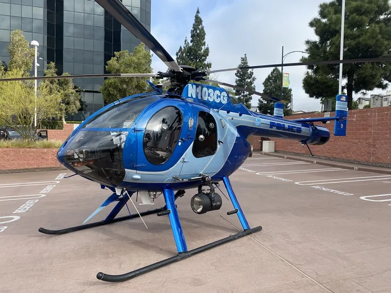
For decades, police air support units relied on dry-erase boards to manage flight schedules, crew assignments, and aircraft status. Supervisors would manually update these boards at the start of each shift, erasing and rewriting critical information that could become outdated within hours during busy operations. Today, law enforcement agencies are replacing these manual systems with real-time digital displays that automatically update flight data, maintenance schedules, weather conditions, and airport status on large screens visible to pilots, tactical flight officers, and supervisors.
This article is designed for police air support supervisors, Real-Time Information Center (RTIC) managers, and public safety IT leaders who are seeking to modernize their operations. Real-time information matters for police air support teams because it improves safety, speeds response, and enhances coordination between air and ground units. By leveraging up-to-the-minute data, agencies can make faster launch decisions, assign the right aircraft and crew, and respond more effectively to emergencies and tactical incidents.
What “Real-Time Information” Means for Police Air Support
Police air support teams utilize real-time information, including live HD video, infrared/thermal imagery, and GPS mapping to enhance ground team safety and tracking. Modern air support systems rely on integrated sensors and communication links to provide real-time intelligence to ground units.
Definition and Scope
Real-time information for police air support refers to aviation-specific data that refreshes automatically every 1-5 minutes on screens used by pilots, tactical flight officers (TFOs), and supervisors. This differs from the broader data aggregation found in a real-time crime center or Real-Time Information Centers, which typically focus on 911 calls, automated license plate readers, CCTV feeds, and body-worn camera footage.
FAA and Weather Data
For an air support unit, real-time displays pull from:
- FAA feeds for NOTAMs (Notices to Air Missions)
- METAR/TAF weather reports for local airports
Internal Scheduling and Maintenance Data
- Internal scheduling databases (Excel, SharePoint, SQL)
- Maintenance management systems tracking aircraft serviceability
- Crew qualification records (NVG currency, instrument ratings)
This aviation-centric approach enables faster launch decisions, safer aircraft assignments, and seamless coordination with ground units during tactical operations, search and rescue missions, and patrol operations. Real-time information systems also provide live intelligence, such as real-time video and imagery, which enhances situational awareness and supports rapid tactical decision-making during critical incidents, mirroring the broader benefits of real-time digital signage seen in other operational environments.
Core Information Types on a Police Air Support Real-Time Display
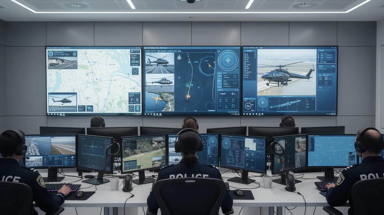
A typical heliport display uses a 55-75 inch screen or video wall running a dashboard presentation created in PowerPoint and powered by SignageTube Live real-time digital signage. The screen divides into distinct zones showing flight schedules, aircraft status, crew rosters, and live weather and airport conditions.
Visual design prioritizes legibility from 5-10 meters using large fonts (72pt or larger for key data), clear color-coding, and intuitive icons. The goal is situational awareness at a glance—officers walking into the heliport immediately see what aircraft are available, who is on duty, and current conditions.
Flight Schedules and Mission Planning
Digital flight boards replace manual scheduling with real-time accuracy. Key fields include:
- Callsign (e.g., Air 1, Air 2)
- Registration (e.g., N123PD)
- Crew (e.g., Pilot: J. Smith, TFO: R. Doe)
- Shift (e.g., 14:00-22:00 PST)
- Mission Type (e.g., Citywide Patrol)
- Radio Channel (e.g., Primary: 155.250 MHz)
On any given day, a display might show Air 1 assigned to citywide patrol from 14:00-22:00, Air 2 on training from 09:00-12:00, and a reserve aircraft on standby. This schedule links to a data source that SignageTube Live polls every few seconds, ensuring any last-minute crew changes appear instantly without manual rewriting.
Maintenance Status Panel
Real-time visibility of aircraft status helps law enforcement respond faster to calls. The maintenance panel displays:
- Tail number and type (e.g., N456BG, Bell 429)
- Current status with color coding: green (Available), yellow (Scheduled Maintenance within 24-72 hours), red (AOG – Aircraft on Ground)
- Next inspection due (100-hour, annual)
- Maintenance notes (e.g., “Avionics check pending”)
This capability supports public safety by ensuring aircraft assignments reflect actual serviceability and preventing delays caused by unexpected faults.
Personnel Rosters
Personnel displays show current and upcoming rosters with critical qualifications:
- Pilot and TFO names with ranks
- Shift times and on-call status
- Qualifications: NVG current, instrument-rated, TFO certified
Integrating this data from Office 365 Excel or SharePoint lists means the display updates every 1-5 minutes. When command staff needs to confirm who is available for an extended surveillance mission or finding missing persons operation, the answer is on the screen—no phone calls or radio traffic required.
Operational Environment: Weather, Airport Conditions, and Airspace
Weather and airport status directly impact launch decisions. Effective displays pull from multiple sources:
Weather Data Integration
- Live METAR/TAF for nearby airports
- FAA feeds for NOTAMs, runway closures, and field conditions
- Local radar and satellite imagery embedded as live web content
Weather tiles show temperature, wind speed, ceiling, and visibility in large, readable formats with timestamps indicating last refresh (typically every 10-15 minutes).
Combining Aviation and Internal Alerts
Crime analysts and operations supervisors can combine these aviation feeds with internal alerts from computer-aided dispatch for complete awareness, leveraging the same principles that make real-time digital signage with SignageTube Live valuable in other mission-critical settings.
Integrating External Data Feeds Safely
Connecting to live external data requires security considerations:
- Use HTTPS web widgets for aviation weather
- Store API keys securely in the SignageTube backend
- Maintain read-only connections to external dashboards
- Separate classified investigative data (handled by RTIC systems) from operational displays
Involve agency IT and security teams when configuring any live feed. External data should appear in clearly labeled panels so operators distinguish official aviation data from internal scheduling information.
Real-Time Information Flow Between RTIC/RTCC and the Air Support Unit
Real-Time Information Centers (RTICs) and Real-Time Crime Centers (RTCCs) are specialized units that collect and deliver real-time intelligence, such as live HD video, infrared/thermal imagery, and GPS mapping, to field personnel and air support teams to enhance ground team safety and tracking.
Real time information centers concentrate on wide-area analytics—CCTV, license plate recognition, body-worn cameras, and 911 data. Air support teams use this feed to prioritize calls from the sky, supporting ground units during pursuits, crowd control situations, and large events, similar to how digital signage for police departments is used to distribute real-time alerts and safety messages.
Police air support teams utilize real-time information, including live HD video, infrared/thermal imagery, and GPS mapping to enhance ground team safety and tracking. Modern air support systems rely on integrated sensors and communication links to provide real-time intelligence to ground units. Real-time information systems help law enforcement agencies optimize their operations and speed up investigations. The San Francisco Police Department’s Real Time Investigation Center (RTIC) has assisted in over 500 arrests since its launch, demonstrating the operational impact of these technologies.
Key RTIC alerts can be summarized and pushed to a “Priority Incidents” panel on the air support display:
|
Case ID |
Location |
Type |
Status |
|---|---|---|---|
|
2026-0316-001 |
Main St & 5th |
Pursuit |
Active |
|
2026-0316-002 |
Riverside Park |
Missing Person |
Searching |
This integration helps law enforcement coordinate resources effectively. When incidents resolve, they automatically clear from the display to avoid clutter. The ability to see real-time intelligence about active situations enables smarter decisions about helicopter deployment.
Supporting Drone as First Responder (DFR) and Helicopter Coordination
Modern police agencies increasingly use drones alongside helicopters. A DFR program can launch a drone within 60-90 seconds of a 911 call, with mission status appearing alongside helicopter flight data, just as other high-tempo sectors listed among the top industries using real-time digital signage rely on instant, data-driven displays.
Helpful data points include:
- DFR launch time and current incident type
- GPS location and streaming status
- Operator assignment
- Mission phase (En Route, On Scene, RTB)
This reduces the “911 gap” by showing air support staff the same real-time data, enabling rapid deployment decisions. Icons distinguish drone missions from helicopter operations, with color-coded status labels for quick identification. Infrared cameras on both platforms provide critical evidence for investigations.

How SignageTube Live Delivers Real-Time Air Support Dashboards
SignageTube is an on-prem-based PowerPoint digital signage solution that connects live data to PowerPoint-based presentations through SignageTube Live technology. Key capabilities for police agencies include:
- Connecting to Excel, CSV, SQL databases, SharePoint lists, and web APIs
- Updating screen content every 30-60 seconds
- Publishing to multiple remote screens across heliports, HQ, and RTICs
- Proof-of-play logging for compliance audits
Units design dashboards in PowerPoint, then bind text boxes and tables to live data sources. This approach lets smaller agencies without dedicated IT resources deploy professional displays quickly.
Typical Deployment Steps for a Police Air Support Unit
A practical rollout follows these steps:
- Inventory data sources — Identify existing spreadsheets, maintenance systems, and weather feeds
- Design prototype layout — Create dashboard slides in PowerPoint
- Connect data via SignageTube Live — Bind fields to live sources and test updates
- Deploy SignageTube player — Install on a dedicated PC or Android device connected to the screen
- Pilot for 30-60 days — Gather feedback from DFR pilots, RTIC staff, and supervisors
- Refine and expand — Adjust layouts, add secondary slides for training calendars or safety notices
Basic deployments take 2-4 weeks, depending on IT approvals. SignageTube supports multi-site management, allowing central teams to control displays across multiple air support bases.

Best Practices for Designing Effective Real-Time Air Support Displays
Effective display design prioritizes clarity:
- Place time-critical information (current flights, aircraft availability, immediate weather) at top/center
- Position secondary data (tomorrow’s schedule, training events) around edges
- Use fonts 72-120pt for 1080p/4K displays viewed from 5-10 meters
- Limit each screen to a few key panels; rotate secondary dashboards using SignageTube scheduling
- Apply agency colors and logos subtly without overwhelming operational data
This data-driven approach helps officers identify critical information instantly, whether responding to suspects in a pursuit or coordinating traffic monitoring.
Data Refresh Rates, Reliability, and Fallbacks
Different data types require different refresh intervals:
|
Data Type |
Recommended Refresh |
|---|---|
|
Flight/Personnel Schedules |
1-5 minutes |
|
Weather/Airport Feeds |
10-15 minutes |
|
RTIC Incident Lists |
30-60 seconds |
SignageTube Live cache last known values if a feed temporarily fails, ensuring displays remain useful during network interruptions. Add “Last updated HH:MM” timestamps for transparency. Coordinate with IT to place players on reliable networks with UPS-backed power for critical displays, especially when you depend on advanced digital signage features of SignageTube Live like centralized control and live data integration.
Future Directions: AI, Predictive Insights, and Expanded Air Support Integration
By 2026 and beyond, police departments are moving from pure real-time information to predictive insights. Emerging capabilities include:
- Predictive maintenance alerts based on aircraft usage patterns
- AI-based weather analysis suggesting optimal launch windows
- RTIC AI analytics flagging incidents most suitable for air support (pursuits, rescue missions, missing persons searches)
Adopting advanced real-time information technologies brings significant benefits, including improved transparency, greater accountability, enhanced officer training, stronger community trust, and measurable crime reduction.
Digital signage could display forecasted demand peaks during large events or weekends based on historical data. Because SignageTube pulls from multiple data sources, it can easily display outputs from new AI tools as agencies adopt them—supporting real-time policing with advanced technology and building on the evolving ecosystem of digital signage software solutions.
These capabilities represent incremental extensions of systems already in place, not distant future concepts.
Conclusion: Turning Real-Time Data into Safer, Smarter Air Support Operations
Moving from manual boards to real-time screen-based dashboards transforms police air support. Officers see up-to-date flight and maintenance visibility, clear personnel status, live weather and airport conditions, and a more organized heliport environment. This enables proactive responses rather than reactive scrambling when events unfold.
Police agencies of any size can protect their communities more effectively with better tools and real-time data.
If you’re a police air support supervisor, RTIC manager, or public safety IT leader, consider a pilot project for your own hangar or air unit. Contact SignageTube to explore how on-prem-based dashboards can reduce crime response times, improve safety, and bring your heliport into the modern era of data-driven operations.